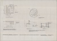
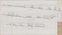
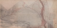
Transvaal Botanic Garden, Roodepoort, Gauteng. Preliminary sketch plan for temporary public parking, and sections showing existing slope and proposed cut and fill.
Transvaal Botanic Garden, Roodepoort, Gauteng. Preliminary sketch plans for temporary and permanent public toilet blocks, including materials to be used. Two plans, two elevations and one section.
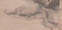
Transvaal Botanic Garden, Roodepoort, Gauteng. Two site plans; elevation of entrance control gate; elevation of parking area entry gate; and sketches of the fence and the causeway.
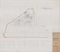
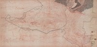
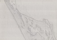
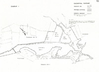
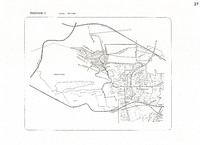
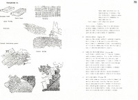
Witwatersrand National Botanical Garden, Roodepoort, Gauteng. Diagram 1: Cadastral diagram showing boundary line of Garden, proposed extension and municipal boundary. Extract from report.
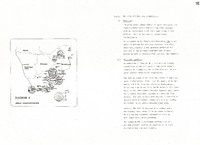
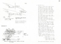
Witwatersrand National Botanical Garden, Roodepoort, Gauteng. Diagram 3: Map of South Africa showing urban concentration. Notes on the national and regional location of the Garden. Extract from report.
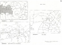
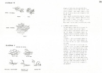
Witwatersrand National Botanical Garden, Roodepoort, Gauteng. Diagrams showing the local setting of the Garden. Diagram 4: Distances. Diagram 5: Major routes of the Witwatersrand. Diagram 6: Local roads. Extract from report.
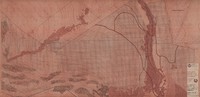
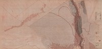
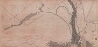
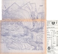
Witwatersrand National Botanical Garden, Roodepoort, Gauteng. Map with key showing the vegetation in the upper part of the Garden. Extract from report.
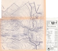
Witwatersrand National Botanical Garden, Roodepoort, Gauteng. Map with key showing the vegetation in the lower part of the Garden. Extract from report.
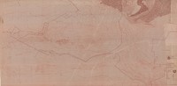
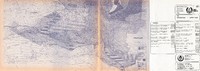
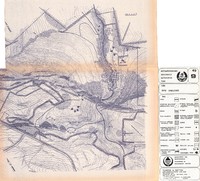
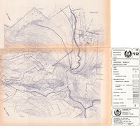
Witwatersrand National Botanical Garden, Roodepoort, Gauteng. Map showing existing structures, such as buildings, bridges and roads. Extract from report.
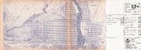
Witwatersrand National Botanical Garden, Roodepoort, Gauteng. Map showing existing infrastructure, such as the electricity network, water reticulation and sewerage system. Extract from report.
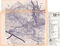
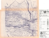
Witwatersrand National Botanical Garden, Roodepoort, Gauteng. Zoning map showing different areas of the Garden, such as the nursery complex, river walks, woodland walks, the lake area, staff accommodation and parking. Extract from report.
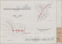
Witwatersrand National Botanical Garden, Roodepoort, Gauteng. Movement systems. Plan showing public walking and vehicular flow, service and staff traffic flow, and public and staff parking. Extract from report.
Witwatersrand National Botanical Garden, Roodepoort, Gauteng. Diagram 13: Drawing of a stormwater retention basin. Notes on proposed service infrastructure, including electricity, water and fencing. Extract from report.
Witwatersrand National Botanical Garden, Roodepoort, Gauteng. Plan of proposed service infrastructure, incuding electricity, reservoir, water reticulation, sewerage system, suggested cable-way, and future fencing. Extract from report.
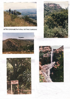
Witwatersrand National Botanical Garden, Roodepoort, Gauteng. Five photographs of the Garden, mounted on board. The waterfall and ruins are indicated on one of the photographs.
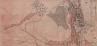
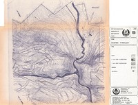
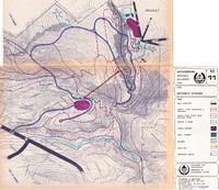
Witwatersrand National Botanical Garden, Roodepoort, Gauteng. Proposed water planning. Indicated on plan: waterfall, canal, dam, water garden, floodplain, reservoir, and suggested dams. Extract from report.
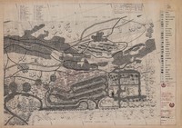
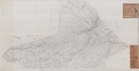
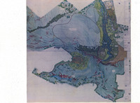
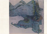
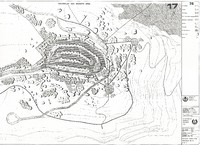
Witwatersrand National Botanical Garden, Roodepoort, Gauteng. Master plan, sheets 1 and 2 (combined and colour-rendered) with annotations (overlaid with acetate). Extract from report.
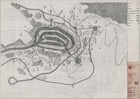
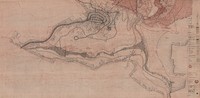
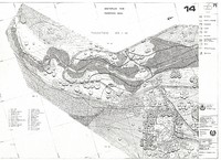
Witwatersrand National Botanical Garden, Roodepoort, Gauteng. Sketch plan of lower section of Garden, sheet 1. Shows trails, roads, canal, streams, vegetation and buildings. Includes a list of trees. Extract from report.
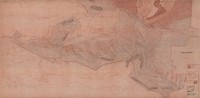
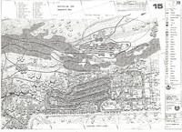
Witwatersrand National Botanical Garden, Roodepoort, Gauteng. Sketch plan of lower section of Garden, sheet 2. Shows fence, trails, roads, water, streams and buildings. Includes a list of trees. Extract from report.
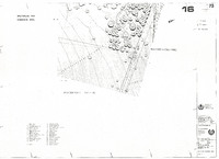
Witwatersrand National Botanical Garden, Roodepoort, Gauteng. Sketch plan of lower section of Garden, sheet 3. Includes a list of trees. Extract from report.
Witwatersrand National Botanical Garden, Roodepoort, Gauteng. Sketch plan of upper section of Garden, sheet 4. Shows fence, trails, roads, cableway, buildings, shrubs and new trees. Extract from report.
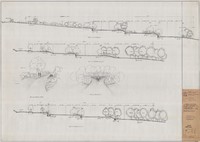
Witwatersrand National Botanical Garden, Roodepoort, Gauteng. Diagram 14: Hierarchy of footpaths and paving according to usage (perspective). Notes on construction materials suitable for roads, paths and trails. Section of an access road. Extract from report.
Witwatersrand National Botanical Garden, Roodepoort, Gauteng. Diagram 15: Types of paving and paving patterns. Notes on surfacing materials for parking areas. Notes on the construction of banks and retaining walls, and steps and ramps. Extract from report.
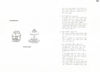
Witwatersrand National Botanical Garden, Roodepoort, Gauteng. Diagram 16: Formal and informal steps. Diagram 17: Edging paths. Sections and sectional perspectives. Notes on steps. Notes on edging and plantings. Extract from report.
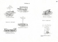
Witwatersrand National Botanical Garden, Roodepoort, Gauteng. Diagram 19: Outdoor seating. Six sketches showing different types of benches. Extract from report.
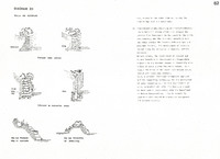
Witwatersrand National Botanical Garden, Roodepoort, Gauteng. Diagram 20: Walls and retaining walls. Sketches of a brick wall, a stone wall, a dry-stone wall and a wall of poles. Sketches of a retaining wall and a shielding wall made of rockery stones. Notes on water resources. Extract from report.